Taraba Postal Code: Jalingo, Wukari, All 16 LGAs and the Mambilla Plateau
Taraba State climbs from the Benue lowlands to the Mambilla plateau, the highest inhabited ground in Nigeria, on roads that make distance a poor guide to delivery time. Codes open 66, run to 672101, and 660001 is the Jalingo head office code.
Taraba completes postal region 6 alongside Borno, Yobe and Adamawa. It is one of the most physically difficult states in Nigeria to serve, running from the Benue lowlands up to the Mambilla plateau, the highest inhabited ground in the country.
Taraba State Postal Code at a Glance
| State capital | Jalingo |
|---|---|
| Head office code | 660001 |
| Code range | 660001 to 672101 |
| Dispatch prefixes | 660, 663, 670, 671 |
| Local Government Areas | 16 |
| Postal region | Region 6 |
| Digits | Six, numeric only |
Reading a Taraba State Code
Take 660001, the Jalingo head office code. The first digit, 6, puts the address in postal region 6. The first three digits, 660, name the dispatch district that sorts outgoing mail. The last three, 001, are the delivery location, and 001 always means the head office itself.
The same three part structure explains why codes inside one town look almost identical while codes from opposite ends of the state look unrelated. Two houses on the same street usually share all six digits, because they share a delivery round. Two houses in different towns rarely share more than the first three.
Every genuine Taraba State code is built the same way, which gives you a quick test. If someone hands you a code for an address in Taraba State and it does not begin with 66, it is not a Taraba State code.
Dispatch Districts in Taraba State
The 660 and 663 blocks cover Jalingo and the central local governments. The 670 and 671 blocks reach south to Wukari and the Benue boundary areas, and east toward the plateau. Road conditions do more to determine delivery times here than distance does, and the block structure reflects which towns are practically reachable from which.
| Dispatch prefix | Codes it issues |
|---|---|
| 660 | 660001 to 660999 |
| 663 | 663001 to 663999 |
| 670 | 670001 to 670999 |
| 671 | 671001 to 671999 |
The 16 Local Government Areas in Taraba State
Taraba has 16 local government areas across terrain that ranges from river lowland to high plateau. Sardauna local government, which contains the Mambilla plateau, is remote enough that it operates almost independently of the rest of the state.
| Ardo Kola | Bali | Donga |
| Gashaka | Gassol | Ibi |
| Jalingo | Karim Lamido | Kurmi |
| Lau | Sardauna | Takum |
| Ussa | Wukari | Yorro |
| Zing |
What you will not find above is a code beside each name, and that is deliberate. NIPOST issues codes to delivery districts, not to local governments. Tables that pair the two are estimates, which is why published lists for Taraba State contradict each other and sometimes contradict themselves.
Two Telephone Codes for Sixteen Local Governments
Taraba carries two fixed line primary centres, 02079 for Jalingo and 02041 for Wukari. For a state with only 16 local governments that is unusual, and it signals what the postal geography confirms: Wukari in the south west functions separately from the capital, oriented toward the Benue crossing rather than toward Jalingo.
The Mambilla Plateau
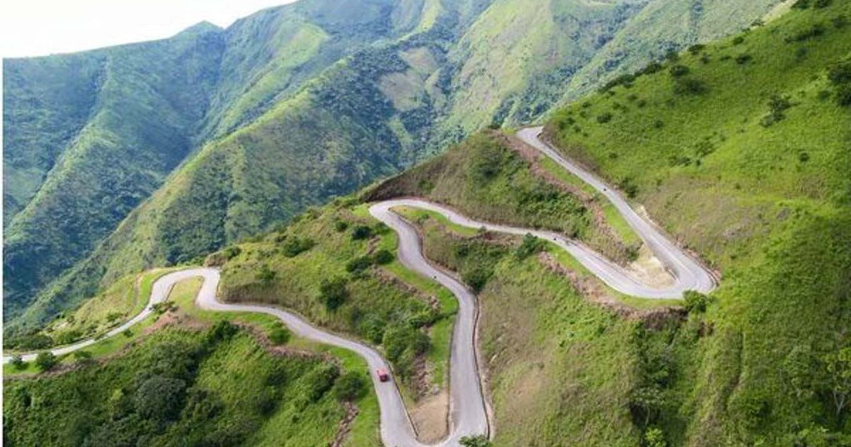
Mambilla sits around 1,500 metres above sea level, is reached by a single difficult road, and grows tea, which nowhere else in Nigeria does at scale. Communities on the plateau are effectively a separate delivery world, served through the local towns with post collected rather than delivered.
Anyone sending to Mambilla should plan for the item to sit at a town office until it is collected, and should name the community, the nearest town and the local government in full.
Wukari, Bali and the Southern Corridor
Wukari is an old Jukun town and the commercial centre for the south of the state, close enough to the Benue boundary that its trade looks south rather than north. Bali sits between the lowlands and the highlands and serves as the last substantial town before the plateau road.
Between these towns lie some of the least developed roads in Nigeria, along with Gashaka Gumti, the country’s largest national park, which occupies a substantial part of the state’s south east and has almost no permanent settlement to code.
Where the Post Stops
Gashaka Gumti, the largest national park in Nigeria, occupies a substantial part of southern Taraba and has almost no permanent settlement in it. There is nothing there to code, and no delivery district covers it in any meaningful sense.
That matters when you are looking at a map and assuming a code exists for somewhere inside or beyond it. Post for communities on the park’s fringe routes through the nearest town office, often by a road that goes around rather than through. Name the town, then the community, and allow more time than the distance suggests.
Post Office Boxes and Private Mail Bags in Taraba State
Boxes are held at a specific branch rather than at a street, which is why the branch name is not optional when you write one out. A private mail bag works the same way, but it is issued to an organisation rather than a person. That is why ministries, universities and large companies publish a bag instead of a street address.
The layout looks like this:
P.O. Box 1234
Jalingo Main Post Office
660001 Jalingo
Nigeria
Two practical notes. A box address is often more reliable than a street address in Taraba State, because it removes the guesswork about which delivery district covers you, and it survives you moving house. But couriers who deliver to the door, which is most of them, cannot deliver to a box at all, so keep a street address for anything that arrives by bike.
Codes Published for Taraba State That Cannot Be Right
We tested the Taraba State tables that circulate online for internal contradictions, meaning two local governments published with ranges that share the same numbers. Taraba State shows none, which puts it among the cleaner states in the country.
That is worth something, but be careful what you read into it. Consistency is not accuracy. It means nobody has published two ranges that openly contradict each other for Taraba State, not that NIPOST ever issued a code to a local government. The safe reading stands: treat block level information as solid and treat any single code attached to a local government as an estimate until your delivery office confirms it.
It is worth knowing how wrong codes get into circulation in the first place, because the same three routes explain almost every bad table online. The first is interpolation, where somebody knows two real codes and fills the gap between them with a tidy range. The second is inheritance, where one site guesses and forty others copy it, which is why a wrong code can look authoritative through sheer repetition. The third is drift, where a code was right when it was published and the delivery district was later split or merged.
You can check any Taraba State code you are given in two steps. Confirm it starts with one of the dispatch prefixes listed above, which rules out codes belonging to another state entirely. Then confirm the last three digits with the delivery office, which is the only part no table can settle for you.
What Happens to a Letter Posted in Taraba State
Knowing the chain explains why the first three digits matter more than the last three. A letter posted anywhere in Taraba State is collected to the nearest branch, then moved to the dispatch office named by the first three digits of the destination code. Outgoing post leaves the state through the region 6 network, and incoming post arrives the same way in reverse, landing at the dispatch office before it is broken down to the delivery round in the last three digits.
The code earns its keep on registered and tracked items. Ordinary post in Taraba State is forgiving, because a postman who recognises the street will deliver it regardless of the digits. Registered items, EMS parcels and anything arriving from abroad are different. Each transfer is handled against the code, so a wrong dispatch prefix can add days or send the item back.
Get the first three digits wrong and your letter travels to the wrong part of the country before anyone notices. Get the last three wrong and it usually still arrives, a day late, because the delivery office recognises the street. This is why a head office code such as 660001 is a safe fallback and a random six digits is not.
How to Write a Taraba State Address
Name the town and the local government in a Taraba address, and add the nearest larger town if you are on the plateau.
The order NIPOST expects runs from the specific to the general, with the code on the same line as the town:
Mr D. Nuhu
7 Hammaruwa Way
Jalingo
660001 Taraba State
Nigeria
Two habits worth breaking. Do not put the code on its own line at the bottom the way American addresses do, because Nigerian sorting reads it beside the town name. And do not drop the state, even for a well known city, because several towns share names across states and the state is what disambiguates them.
Neighbouring Codes in Region 6
Taraba State shares its postal region with the states below. If a code you have been given starts with one of their prefixes, the address is not in Taraba State.
| State | Prefix |
|---|---|
| Borno | 600 |
| Yobe | 620 |
| Adamawa | 640 |
Tracking Down Your District Code
- Ask at the counter of the post office that serves your street. Staff there work from the delivery district list daily and can give you the exact code.
- Search the NIPOST postcode finder by address rather than by local government.
- Where the delivery is informal anyway, use 660001, the Jalingo head office code, which routes correctly across the state.
What to Type When a Form Demands a Code
Type 660001 if you are in or near Jalingo and do not know your district code. Six digits, no spaces. Avoid 23401 and 00000, which are not NIPOST codes and mean nothing to a sorting office even though most websites accept them.
If a foreign site rejects the code because it wants five digits, that is a validation fault on their end rather than a problem with your address. Enter the six digits wherever the form allows it, and never invent a shorter code for anything a bank, an embassy or a courier will check.
The New Code Coming in October
From 1 October 2026 Nigeria moves to a new 11 character postcode that identifies a single building rather than a sorting district. On the Mambilla plateau, a building level code would give communities an address that currently exists only as a name on a district round.
Key Details
- Taraba State head office code: 660001
- Range: 660001 to 672101
- Dispatch prefixes: 660, 663, 670, 671
- Local Government Areas: 16
- Capital: Jalingo
- New alphanumeric postcode: 1 October 2026
Questions People Ask
What is the zip code for Jalingo?
Jalingo head office is 660001. All Taraba codes begin 66 or 67, with the state range running to 672101.
What is the postal code for Wukari?
Wukari is served from the southern block group. It is the state’s second centre and has its own telephone area code, 02041, separate from Jalingo’s 02079.
How does post reach the Mambilla plateau?
Through the local town offices, with items usually collected rather than delivered. Name the community, the nearest town and the local government in full.
How many local governments does Taraba have?
Sixteen, across terrain running from the Benue lowlands to the Mambilla plateau.
Why does Taraba have two telephone area codes?
Because Wukari in the south west operates separately from Jalingo, orientated toward the Benue crossing. The postal structure splits the same way.
Why do Taraba codes start with 6?
The first digit is the postal region. Taraba is region 6 with Borno, Yobe and Adamawa, and Maiduguri holds the anchor at 600001.
Is delivery slower in Taraba than in other states?
Often, yes, and the reason is roads rather than distance. Plan for longer transit to the southern corridor and considerably longer to the plateau.
What should I put on a form for a Taraba address?
Use 660001 for Jalingo and the centre of the state, or the Wukari district code if your address is in the south west.
In Brief
Taraba codes begin with 66 or 67 and run from 660001 to 672101. Jalingo head office, 660001, is the code for forms. Sixteen local governments cover terrain from river lowland to the Mambilla plateau, with Wukari operating as a separate southern centre and road conditions doing more to shape delivery than distance.
Before You Post Anything
Use 660001 on forms, or Wukari’s districts if you are in the south west. For the plateau, name the community, the town and the local government, and expect collection rather than delivery.